


 CDN NEWS |
  US NEWS


![]()
Aerostar Drone Solutions, a leader in UAV Inspections, is pleased to announce that it has recently added UAV LiDAR Scanning & 3D Modelling to its portfolio of UAV Inspections.
The addition of LiDAR scanning continues to advance Aerostar’s UAV inspection capabilities to many industries in both Canada and the USA.
LiDAR (Light Detection and Ranging) is a remote sensing technology which utilizes a laser to collect survey grade measurements which can be beneficial for industries including Oil & Gas, Petrochemical, Power & Utilities, Mining, Forestry, Railway and Agriculture.

UAV with the Lidar Scanner
Specific applications of LiDAR Scanning include:
- Surface Pipeline & ROW Inspection
- Slope stability monitoring
- Erosion measurement due to High Water events
- Overhead Power Transmission Lines
- Ground Contouring Models
- Spill Mapping
- Incident Response and Post Incident Investigation
- Facility Mapping & Modelling
- Civil Engineering & Surveying
- Infrastructure Management
- Distance, Area, and Volume Measurements
- Forest & Tree Metrics
Pipeline & Overhead Utility Line Example Images
HD Inspection Image
LiDAR Inspection Image
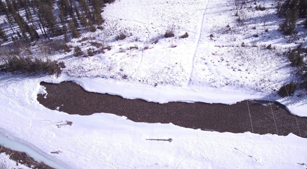
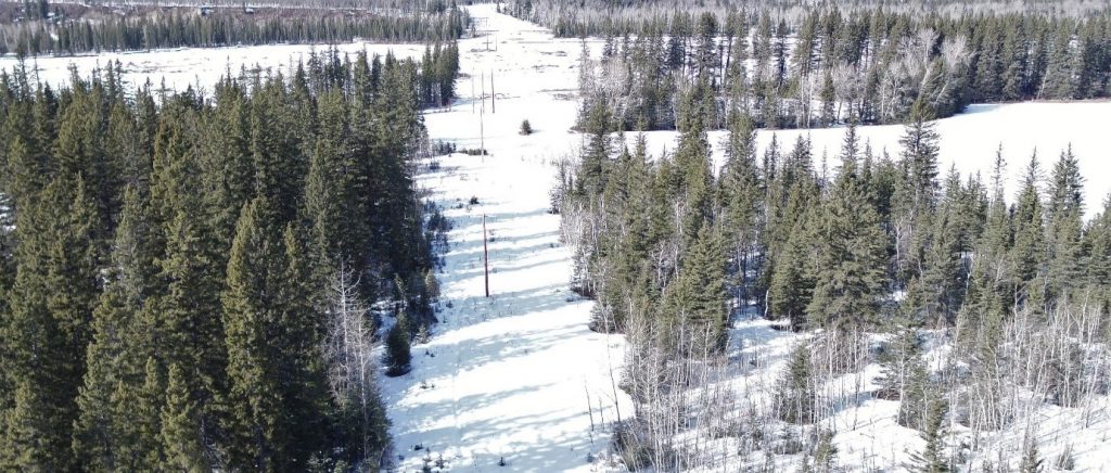
Pipeline ROW Water Crossing HD Image
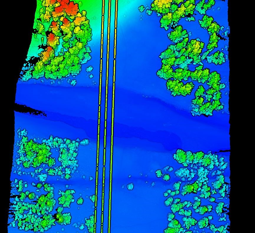
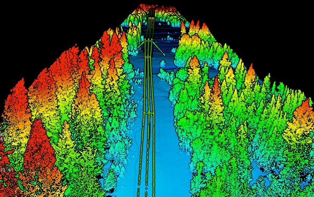
Pipeline ROW Water Crossing LiDAR Image
Contact Aerostar today to learn more about how LiDAR Scanning can benefit your business.
About Aerostar
Aerostar Drone Solutions is an industry leader in providing UAV Inspections for many industries. Our UAV pilots have advanced certification by Transport Canada and are also licensed to fly in the United States. In addition, Aerostar has positive compliance ratings with ISNetworld, Complyworks and Avetta. The use of UAV Technology has been proven to reduce costs, reduce the risk to people and provide an environmentally friendly solution for companies managing their assets.
For more information, please visit – http://www.aerostardronesolutions.com
Or contact:
Darren Jackson (587) 577-1565
Kurt Hewitt (780) 830-8303
Share This:


COMMENTARY: Taxes and Regulations Will Increase the Cost of Producing New Energy In Alberta, Making it Less Competitive Than the US – Jack Mintz