


 CDN NEWS |
  US NEWS






EnergyNow Special Report
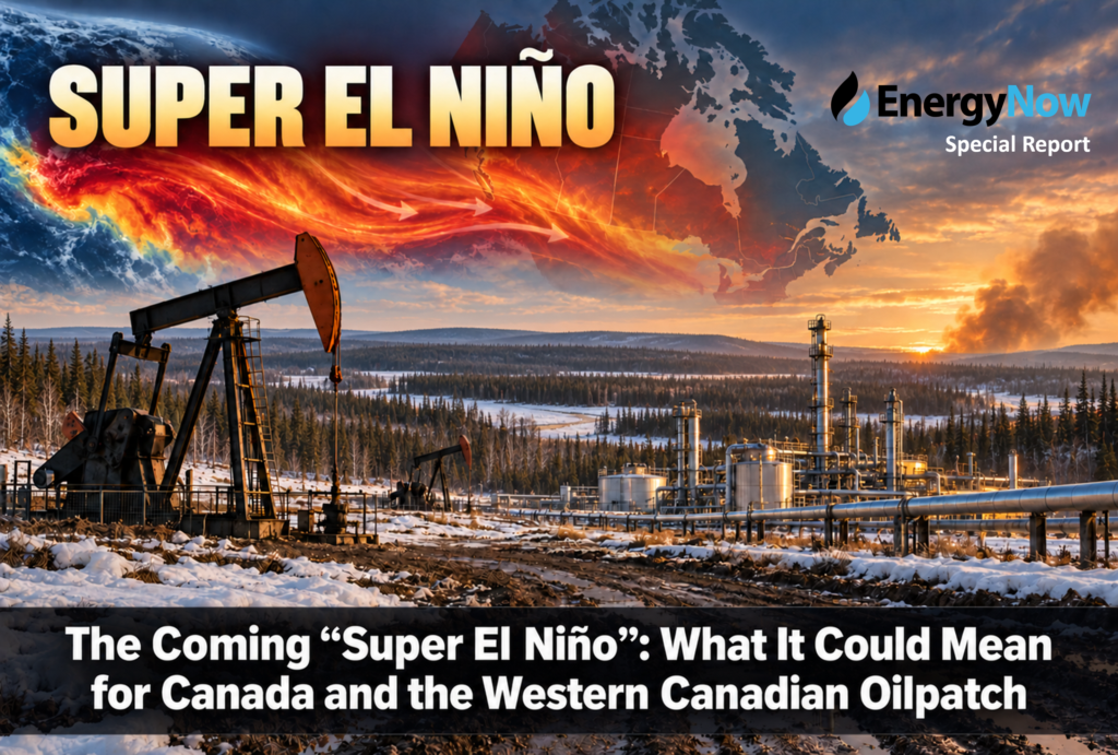
A potentially historic El Niño is strengthening in the tropical Pacific and is expected to influence global weather through the remainder of 2026 and into 2027.
NOAA currently estimates a greater than 90% probability that the event will reach “very strong” intensity during the fall and winter of 2026–27. Its August outlook also assigned a 69% probability that the event could exceed every previous El Niño measured since 1950 during the October–December period. The World Meteorological Organization similarly expects the event to become very strong toward the end of 2026. NOAA Climate Prediction Center, World Meteorological Organization
That is why it is increasingly being described as a “Super El Niño.” However, that term is informal. NOAA and other official agencies classify events as weak, moderate, strong or very strong—they do not maintain a formal “super” category.
What Is El Niño?
El Niño is the warm phase of the El Niño–Southern Oscillation, or ENSO: a recurring interaction between the tropical Pacific Ocean and the atmosphere.
During an El Niño:
- Surface waters across the central and eastern equatorial Pacific become unusually warm.
- Trade winds weaken.
- Tropical rainfall and thunderstorms shift eastward.
- The position and strength of the jet streams change.
- Those atmospheric changes alter temperature, precipitation and storm patterns far beyond the Pacific.
An event is generally classified as very strong when the three-month average temperature in the Niño 3.4 region of the Pacific reaches at least 2°C above normal. Current modelling indicates this event could meet or exceed that threshold.
But El Niño does not create the same weather everywhere, nor does it guarantee a particular outcome in any one city. It changes the odds. Other influences—including Arctic circulation, the polar vortex, Pacific coastal temperatures and short-term weather systems—can reinforce or offset its effects.
Likely Effects Across Canada
The strongest Canadian signal usually occurs during late fall, winter and early spring.
Western Canada: Warmer Winter Is the Leading Risk
British Columbia, Alberta, Saskatchewan and the Northwest Territories generally experience their clearest El Niño effect through above-normal winter temperatures.
That could mean:
- Fewer prolonged Arctic cold outbreaks
- More freeze-thaw cycles
- A shorter period of continuous snow cover
- More winter precipitation falling as rain rather than snow
- Reduced snowpack at lower and middle elevations
- Earlier spring melting and breakup
Major cold snaps can still occur. A warmer seasonal average does not mean Western Canada will avoid periods of extreme cold; it means those episodes may be less frequent or shorter-lived.
British Columbia: Lower Snowpack and Water-Supply Concerns
Southern and interior British Columbia often experience warmer and, in some areas, drier El Niño winters. If mountain snowfall is suppressed, the consequences could carry well into 2027:
- Lower spring snowpack
- Earlier runoff
- Reduced summer streamflow
- Greater drought potential
- An earlier or more severe wildfire season
Agriculture and Agri-Food Canada has already warned that an El Niño-driven warm and dry pattern could intensify drought in parts of Western Canada. Canadian Drought Outlook
Coastal British Columbia could also experience fewer major snow events, although individual storms remain possible.
Prairies: Mild but Potentially Dry
Alberta, Saskatchewan and Manitoba are likely to lean warmer than normal through the winter. Precipitation is harder to predict because seasonal precipitation forecasts have considerably less skill than temperature forecasts.
A dry winter would be the greater concern because it could:
- Prevent the recovery of depleted soil moisture
- Produce a shallow snowpack
- Reduce spring runoff
- Extend drought conditions into the 2027 growing season
- Increase grassfire and forest-fire risk
Conversely, a warmer winter accompanied by periodic snowfall could reduce some of these risks. The amount and geographical distribution of precipitation will therefore be more important than the “Super El Niño” label alone.
Central and Eastern Canada
Ontario and Quebec could also experience above-normal winter temperatures, although the connection is generally less consistent than in Western Canada. Potential effects include:
- Reduced heating demand
- More mixed precipitation and freezing rain
- Fewer sustained periods of extreme cold
- Greater temperature volatility around the freezing point
Atlantic Canada’s response is less predictable. El Niño can influence the storm track, but ocean temperatures and North Atlantic circulation frequently become more important regional factors.
What It Could Mean for the Western Canadian Oilpatch
For the oil and gas industry, a powerful El Niño presents a mix of possible operating advantages and material risks.
1. Lower Natural-Gas Heating Demand
A mild winter across Canada and the northern United States would likely reduce natural-gas consumption for residential and commercial heating.
That could:
- Put downward pressure on AECO and Henry Hub prices
- Slow storage withdrawals
- Leave inventories relatively high entering spring
- Widen regional gas-price discounts during periods of pipeline maintenance or constrained takeaway capacity
- Reduce cash flow for gas-weighted Western Canadian producers
This is potentially the largest direct financial risk. A difference of only a few degrees across major population centres can materially alter continental gas demand.
However, growing gas consumption from LNG facilities, power generation and data centres could provide some support. LNG Canada demand also gives Western Canadian production a new outlet that did not exist during earlier powerful El Niño events.



2. Reduced Freeze-Offs and Cold-Weather Interruptions
A warmer winter could benefit field operations by reducing:
- Wellhead and gathering-system freeze-offs
- Equipment failures
- Worker exposure to extreme cold
- Road closures caused by severe storms
- Power interruptions and emergency maintenance
- Heating costs at field facilities
Oil-sands plants, conventional fields, pipelines and gas-processing facilities could experience better winter reliability and fewer short-duration production losses.
3. A Shorter Winter Drilling Season
The operational benefit of mild weather has an important downside.
Many remote sites in northern Alberta and northeastern British Columbia depend on frozen ground, ice roads and temporary winter access. If freeze-up comes late or the ground thaws early:
- The winter drilling window could shrink.
- Heavy equipment might not be able to reach remote locations.
- Seismic, pipeline and construction programs could be compressed.
- Operators may have to postpone work or use more expensive access alternatives.
- Service companies could experience scheduling congestion followed by an early slowdown.
This would particularly affect activity in muskeg and environmentally sensitive northern areas. Producers with all-weather access would be less exposed.
4. Earlier Spring Breakup and Road Restrictions
Warmer late-winter and early-spring conditions could bring an early breakup in 2027.
Soft roads and thawing lease sites can trigger weight restrictions and reduce access for:
- Drilling rigs
- Fracturing fleets
- Vacuum and fluid-hauling trucks
- Construction equipment
- Pipe and materials deliveries
An earlier breakup could shift more drilling and completion activity into the second half of 2027. It could also produce a sharper seasonal slowdown for oilfield service companies during March, April and May.
A sudden warm period is not necessarily beneficial. Rapid thawing or rain falling on snow can cause localized flooding, washouts and damage to access roads.
5. Water Availability for Operations
A weak snowpack followed by an early melt could reduce summer water availability in parts of Alberta and British Columbia.
Potentially exposed activities include:
- Hydraulic fracturing
- Drilling and completions
- Dust suppression
- Pipeline construction
- Oil-sands processing
- Industrial firefighting reserves
Large oil-sands operators generally have water-management and recycling systems that provide greater resilience. Smaller producers and service companies relying on local surface-water sources may be more vulnerable to withdrawal restrictions or higher water-transportation costs.
6. Increased Wildfire Risk in 2027
If El Niño produces a warm, dry winter with below-normal snowpack, the risk could carry directly into the 2027 wildfire season.
The most vulnerable regions would include:
- Northeastern British Columbia
- Northwestern and north-central Alberta
- The Peace River region
- The boreal forest surrounding Fort McMurray
- Northern Saskatchewan
Wildfires can force the evacuation of workers, close highways, interrupt electricity and communications, halt drilling and shut in producing wells. Smoke can also restrict aircraft movements and make outdoor work unsafe.
The risk is conditional rather than certain: substantial winter snowfall or sustained spring rain could materially improve the situation.
7. Electricity and Hydroelectricity
Reduced mountain snowpack and lower streamflows could affect hydroelectric output in British Columbia during 2027. Lower hydro availability could:
- Increase electricity-import requirements
- Raise regional power prices
- Increase gas-fired generation
- Add pressure to industrial electricity costs
- Create additional demand for natural gas
That provides a partial counterweight to lower winter heating demand. Natural-gas prices could weaken during a mild winter but receive support later from increased gas-fired power generation if hydro conditions deteriorate.
8. Oil Prices Could Be Affected Indirectly
El Niño itself is unlikely to be the main driver of crude prices, which will remain dominated by geopolitics, OPEC+ policy, U.S. production, global economic conditions and the Iranian conflict.
Nevertheless, an unusually warm Northern Hemisphere winter could reduce consumption of heating oil, diesel and other winter fuels. That could:
- Weaken refinery margins
- Slow seasonal petroleum demand
- Increase product inventories
- Place modest downward pressure on crude prices
The reverse could occur elsewhere if El Niño causes drought, flooding, crop losses, power shortages or infrastructure disruptions severe enough to increase energy use or interfere with supply.
Possible Timeline
| Period | Most likely concerns for the oilpatch |
|---|---|
| September–November 2026 | El Niño strengthens; warmer fall; delayed freeze-up; continued drought monitoring |
| December 2026–February 2027 | Warmer-than-normal winter risk; weaker heating demand; fewer freeze-offs; reduced winter access |
| March–May 2027 | Earlier breakup; road restrictions; runoff and snowpack become critical indicators |
| June–September 2027 | Possible drought, water constraints and wildfire risk if winter snow and spring rain are inadequate |
Bottom Line
A very strong El Niño appears increasingly likely, but calling it a “Super El Niño” should not be interpreted as a precise forecast of catastrophic Canadian weather.
For the Western Canadian oilpatch, the most probable near-term effect is a warmer winter that improves equipment reliability while weakening natural-gas heating demand. The greater operational danger could emerge later: delayed freeze-up, a shortened winter drilling season, early spring breakup and—if the winter is also dry—water shortages and elevated wildfire risk in 2027.
The four indicators the industry should watch most closely are:
- Western Canadian winter snowfall
- December-through-February temperature anomalies
- March 2027 mountain and Prairie snowpack
- Spring precipitation in northern Alberta and northeastern British Columbia
Those measurements will ultimately determine whether the event proves mainly helpful, through lower winter operating costs, or harmful through weak gas prices, restricted access, drought and wildfire disruptions.
Share This:





















On The Verge: Energy Sector Primed for New Wave of Growth – ATB Economics